Field Site
linking 3D particle-scale structures to the evolution of gravel bed morphology
Field site
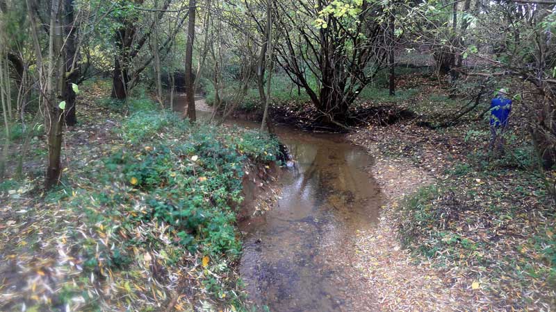
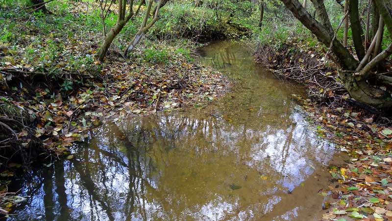
Field measurements will be made in Bury Green Brook (BGB), Bishop’s Stortford, UK (Fig. 1). This is a proven field site for assessing spatially variable sediment structure.

Dimensions
Logistically the size of the channel (mean bankfull width 3.4 m, mean bankfull depth 1.3 m, previously measured reach ~60 m length) is appropriate for the high-resolution data that we will collect (Fig. 2 and 3). Although the channel is relatively small, the research findings will be upscaled to larger rivers.
Flow
The channel is ephemeral, being dry for 3 months of the year, allowing prolonged access to the bed which is necessary for the laser scanning and other measurements. Although alluvial streams are not characteristically ephemeral, the bed is water-worked during the 9 months of the year including frequent flood events separated by periods of flow recession common to other alluvial streams. Prior to this project, BGB was ungauged, but channels in the area receive multiple bankfull flows a year and there is active sediment transport.
Sediment
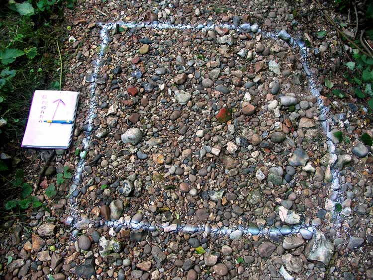
The sediment grain sizes found in BGB are appropriate for the application of TLS (i.e. individual particles large enough to be distinguished in scan data) (Fig. 4). Previous work has demonstrated the occurrence of mortaring from fine sediment, which is a key aspect of this proposal. The river-bed morphology includes riffle-pool and plane bed morphologies which are:
- the most common bedforms found in gravel-bed rivers, hence the research has wide application, and
- provides an opportunity to quantify structural contrasts under different bed morphologies and ranges of stress history.
Suggested Reading
(Pdf) Hodge, R., Sear, D.A. and Leyland, J. (2013) Spatial variations in surface sediment structure in riffle-pool sequences: a preliminary test of the Differential Sediment Entrainment Hypothesis (DSEH). Earth Surface Processes and Landforms, 38(5), 449-465 (doi:10.1002/esp.3290)